United States Geological Survey

Results: 4320


#Item
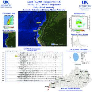
51April 16, 2016 Ecuador (M:58:37 UTC / 19:58:37 at epicenter University of Kentucky Kentucky Seismic and Strong Motion Network USGS Shake Map

April 16, 2016 Ecuador (M:58:37 UTC / 19:58:37 at epicenter University of Kentucky Kentucky Seismic and Strong Motion Network USGS Shake Map

Add to Reading List

Source URL: www.uky.edu

Language: English - Date: 2016-04-18 13:17:00
52149  Cartographic Data Bases Panel Frederick R. Broome, Presiding

149 Cartographic Data Bases Panel Frederick R. Broome, Presiding

Add to Reading List

Source URL: mapcontext.com

Language: English - Date: 2008-08-29 21:32:20
53Microsoft Word - NED_Release_Notes_Apr13.doc

Microsoft Word - NED_Release_Notes_Apr13.doc

Add to Reading List

Source URL: nationalmap.gov

Language: English - Date: 2013-10-22 12:06:50
54The Minerals4EU Foundation, the new private-public bridge for the EU Raw Materials sector Brussels, 04 MarchFollowing the huge success of the European Intelligence Network on the Supply of Raw

The Minerals4EU Foundation, the new private-public bridge for the EU Raw Materials sector Brussels, 04 MarchFollowing the huge success of the European Intelligence Network on the Supply of Raw

Add to Reading List

Source URL: www.eurogeosurveys.org

Language: English - Date: 2016-04-15 07:53:23
55AREAL AND TEMPORAL VARIABILITY OF SELECTED WATER-QUALITY CHARACTERISTICS IN TWO HYDROLOG1C-BENCHMARK BASINS IN THE NORTHEASTERN UNITED STATES Robert A. Hainly and John R. Ritter  U.S. GEOLOGICAL SURVEY

AREAL AND TEMPORAL VARIABILITY OF SELECTED WATER-QUALITY CHARACTERISTICS IN TWO HYDROLOG1C-BENCHMARK BASINS IN THE NORTHEASTERN UNITED STATES Robert A. Hainly and John R. Ritter U.S. GEOLOGICAL SURVEY

Add to Reading List

Source URL: ny.cf.er.usgs.gov

Language: English - Date: 2013-02-05 11:34:33
56Using the channel profile analysis tool, built by the University of Edinburgh Land Surface Dynamics group Part A: Extracting the channel network from a DEM Simon M. Mudd, Mikaël Attal, David T. Milodowski, Stuart W.D. G

Using the channel profile analysis tool, built by the University of Edinburgh Land Surface Dynamics group Part A: Extracting the channel network from a DEM Simon M. Mudd, Mikaël Attal, David T. Milodowski, Stuart W.D. G

Add to Reading List

Source URL: csdms.colorado.edu

Language: English - Date: 2013-09-12 07:38:07
57Minnesota Ground-Water Information Resources

Minnesota Ground-Water Information Resources

Add to Reading List

Source URL: www.mgwa.org

Language: English - Date: 2008-12-09 15:54:24
58Subcommittee on Spatial Water Data Meeting Details: Date/Time: August 28, 2014, 10:00 AM - 12:00 PM Location: Room 3B457, USGS Headquarters, 12201 Sunrise Valley Drive, Reston, VA Conference Line: (Code 106

Subcommittee on Spatial Water Data Meeting Details: Date/Time: August 28, 2014, 10:00 AM - 12:00 PM Location: Room 3B457, USGS Headquarters, 12201 Sunrise Valley Drive, Reston, VA Conference Line: (Code 106

Add to Reading List

Source URL: acwi.gov

Language: English - Date: 2014-09-09 09:30:41
59INTERACTIVE CARTOGRAPHY, SMALL SYSTEMS  There were two Interactive Cartography, Small Systems sessions. Both of these sessions were chaired by Howard Carr of the U.S. Army Engineering Topographic Laboratory and James Car

INTERACTIVE CARTOGRAPHY, SMALL SYSTEMS There were two Interactive Cartography, Small Systems sessions. Both of these sessions were chaired by Howard Carr of the U.S. Army Engineering Topographic Laboratory and James Car

Add to Reading List

Source URL: mapcontext.com

Language: English - Date: 2008-08-29 23:37:33
60TESTING LARGE-SCALE DIGITAL LINE GRAPHS AND DIGITAL ELEVATION MODELS IN A GEOGRAPHIC INFORMATION SYSTEM by David R. Wolf U.S. Geological Survey 521 National Center

TESTING LARGE-SCALE DIGITAL LINE GRAPHS AND DIGITAL ELEVATION MODELS IN A GEOGRAPHIC INFORMATION SYSTEM by David R. Wolf U.S. Geological Survey 521 National Center

Add to Reading List

Source URL: mapcontext.com

Language: English - Date: 2008-08-30 00:55:51